Project description

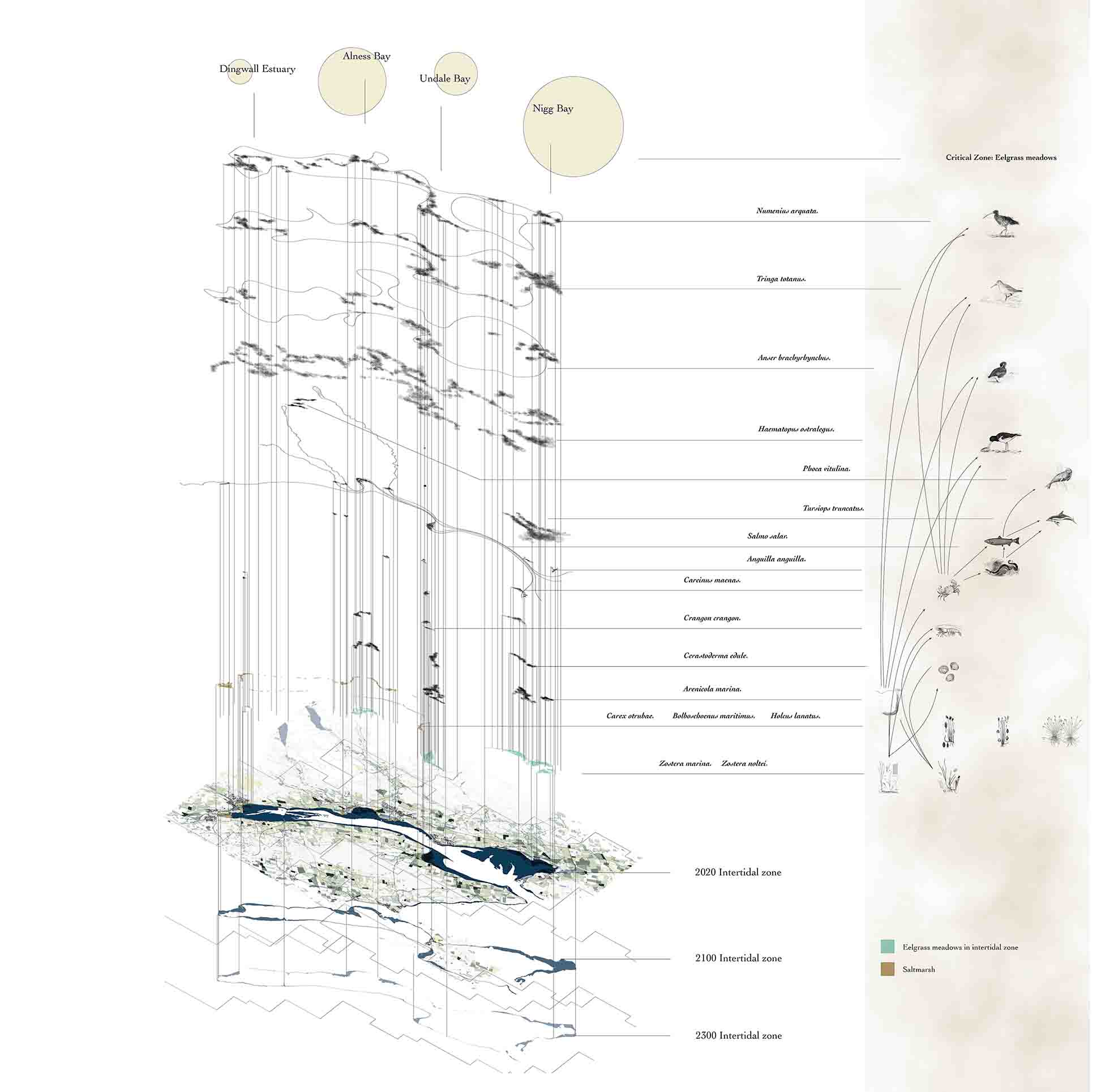
Under the circumstance of climate change and sea-level rise, low-lying coastal areas around the world will be exposed to varying degrees of vulnerability and coastal risk, and the Cromarty Firth is no exception. This design starts at focusing on the human and non-human coastal risks caused by sea-level rise in the Cromarty region, especially the intertidal eelgrass meadows degradation, saltmarsh shrinkage, and coastal world war II historical heritage disappearing problems.

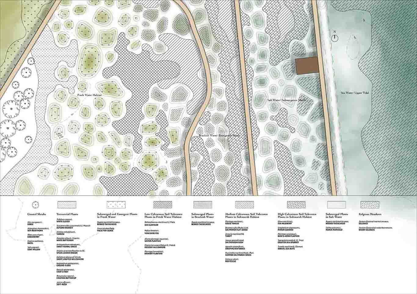
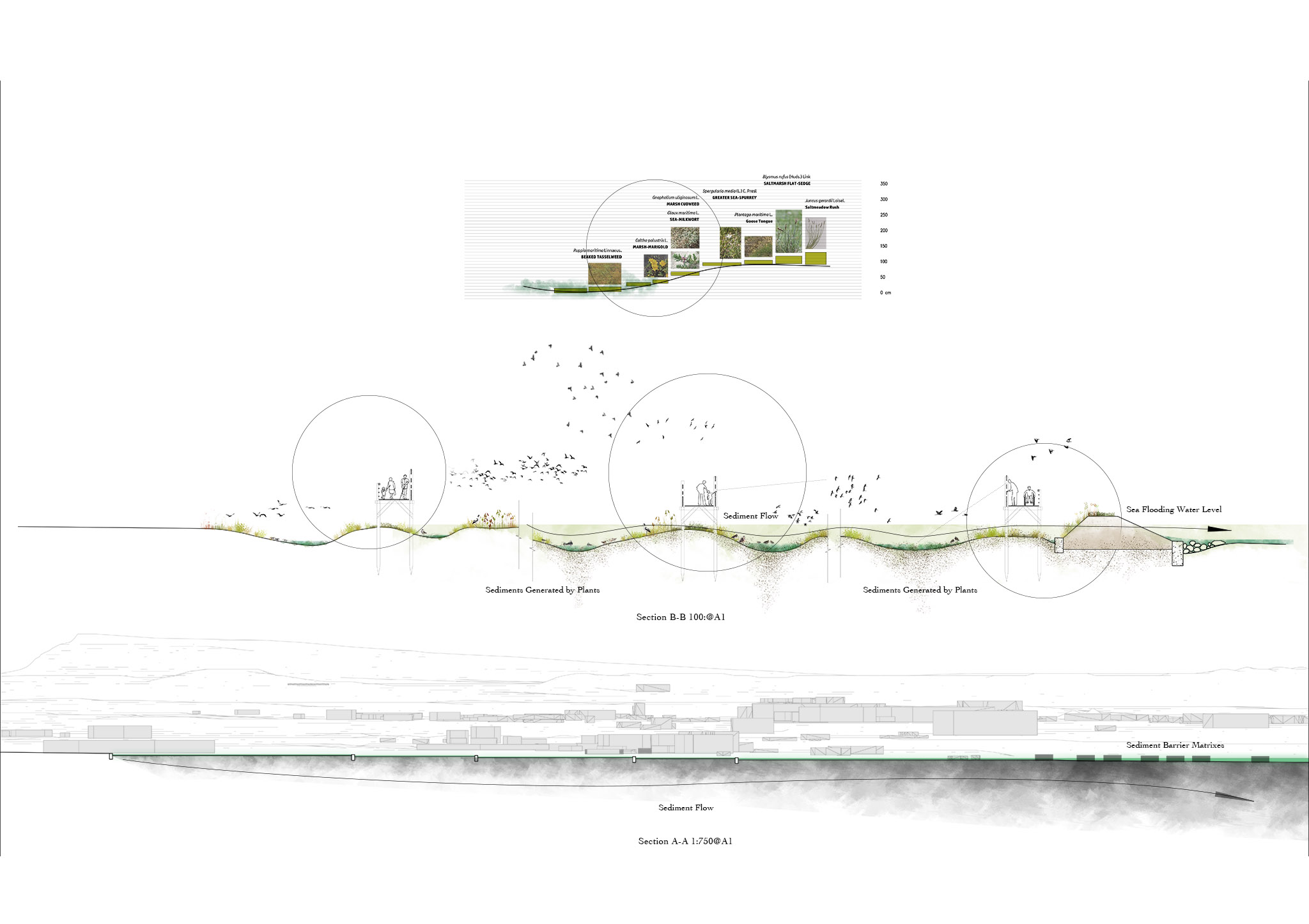
n this landscape design project, a coastal geopark sequence will be implemented in the future to deal with the problems above. The basic strategy of this project is sediment management. Since sediment is the main driver of creating coastal habitats such as eelgrass meadows and saltmarsh. And also, the sediment process is a very slow process that is compatible with the speed of sea-level rise. So, with reasonable artificial sediment management, the negative impact of sea-level rise can be greatly reduced.

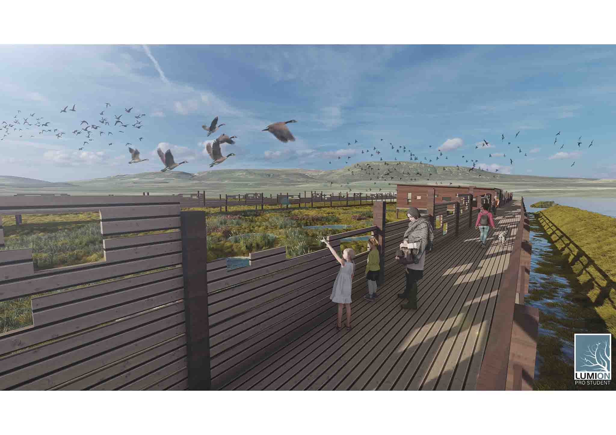
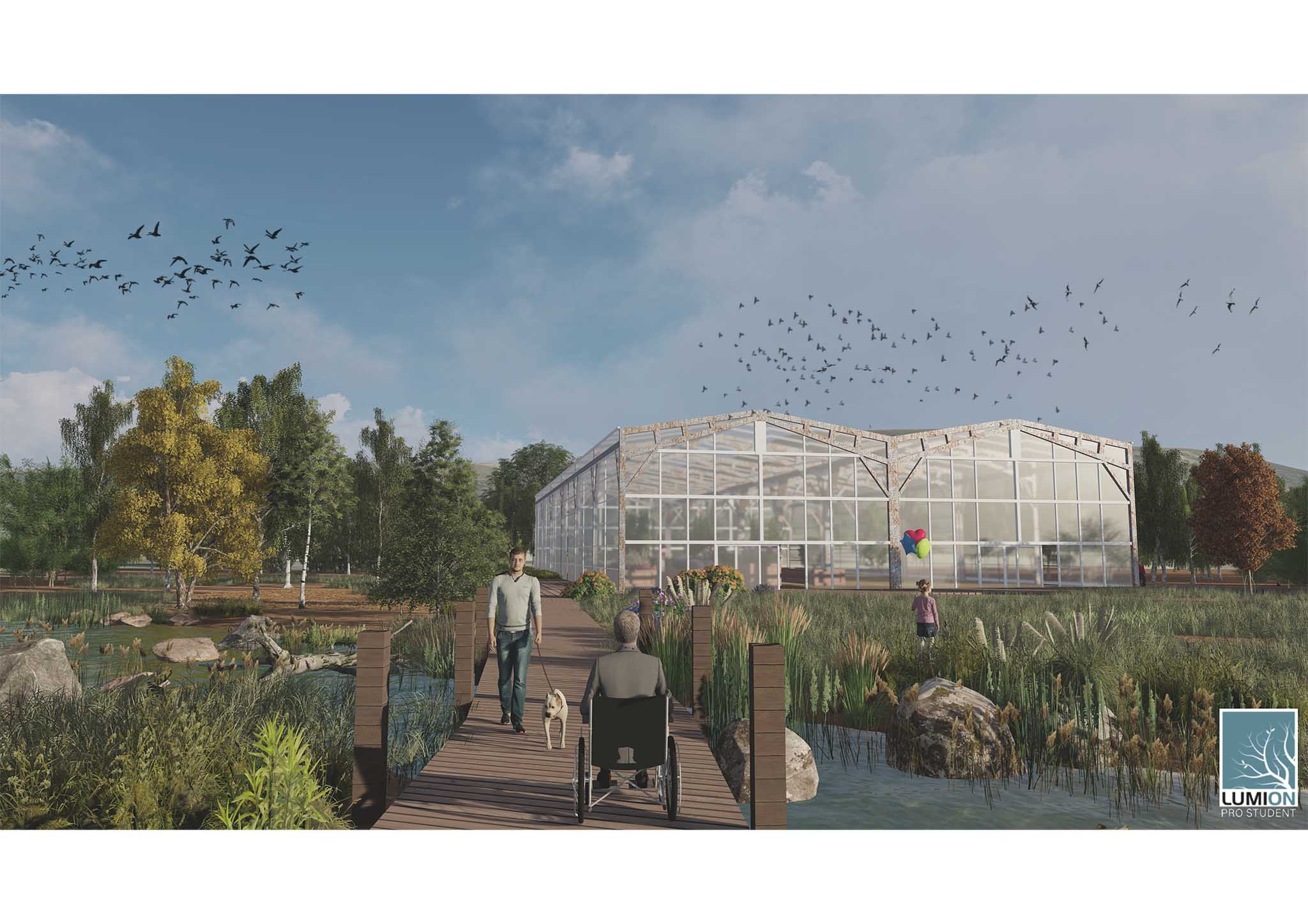
Managing sediment can be implemented from two sides. One is increasing the amount of sediment that flows into the ocean from land and another is intercept sediments so that they are not washed away by ocean currents. In this project, the purpose of increasing sediment is achieved by transforming the coastal historical heritage landscape into more natural landscape such as water body, artificial saltmarsh to generate and transport sediment. The aim of catching sediments is achieved by designed sediment barrier matrixes in the tidal zone. These sediment barriers will recycle the material from the disused oil rigs in Cromarty Firth, making these ghost of the Anthropocene reborn in the future. With all these management tools, the intertidal zone will be lifted by the sediment and keep pace with the sea level rising speed so the eelgrass and saltmarsh will always stay in a shallow seawater condition and keep existing.

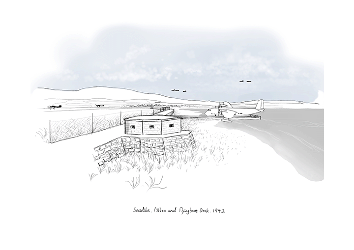
The transformed coastal historical heritage also plays an important role in the project. It not only helps to generate natural sediments but also helps to keep the specific characters of local historical landmarks. The transforming design aims to conserve the disappearing heritage under threats of sea-level rise. So, with the sediment management tools, these memorial sites find their ways to having eternal life.

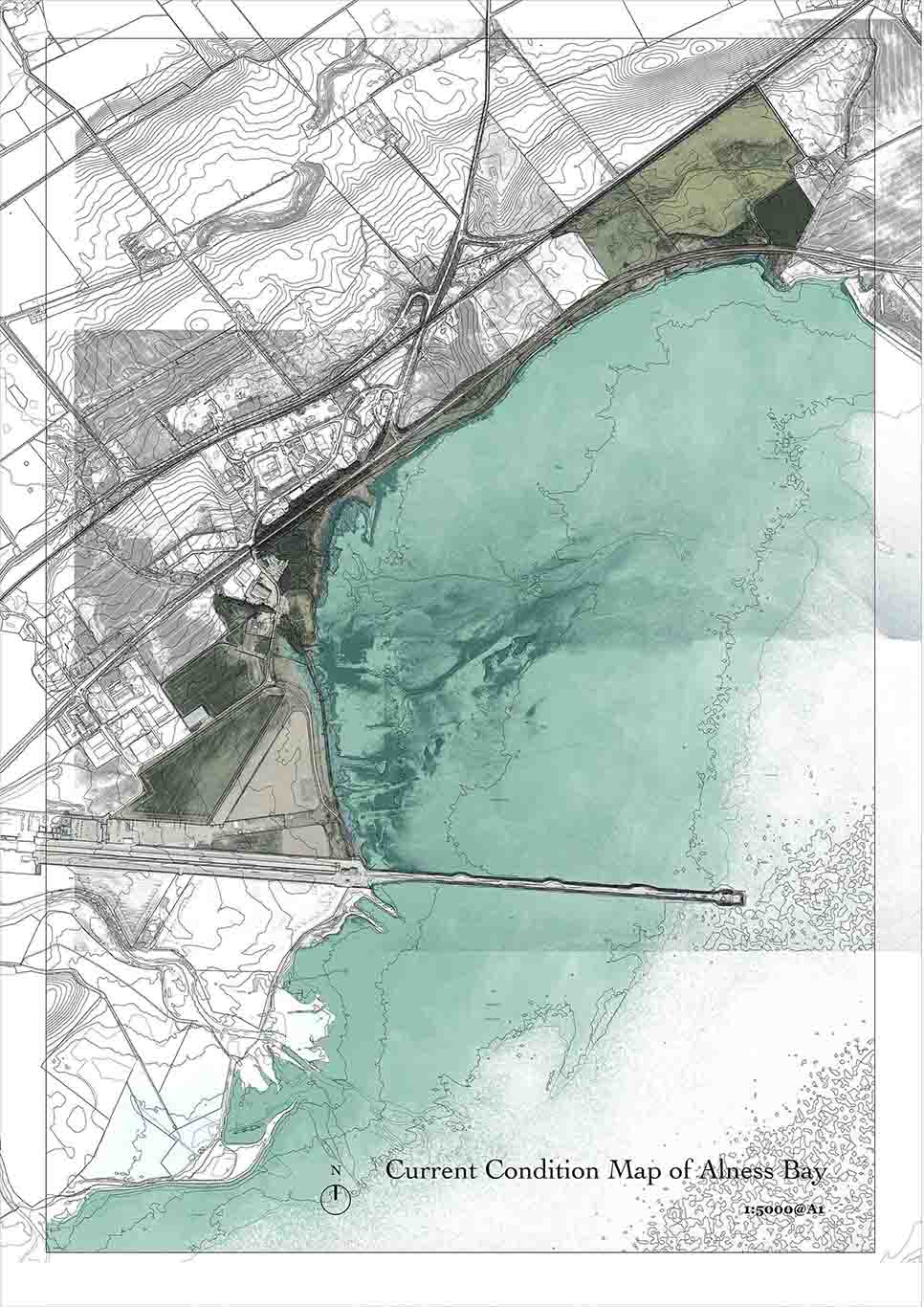
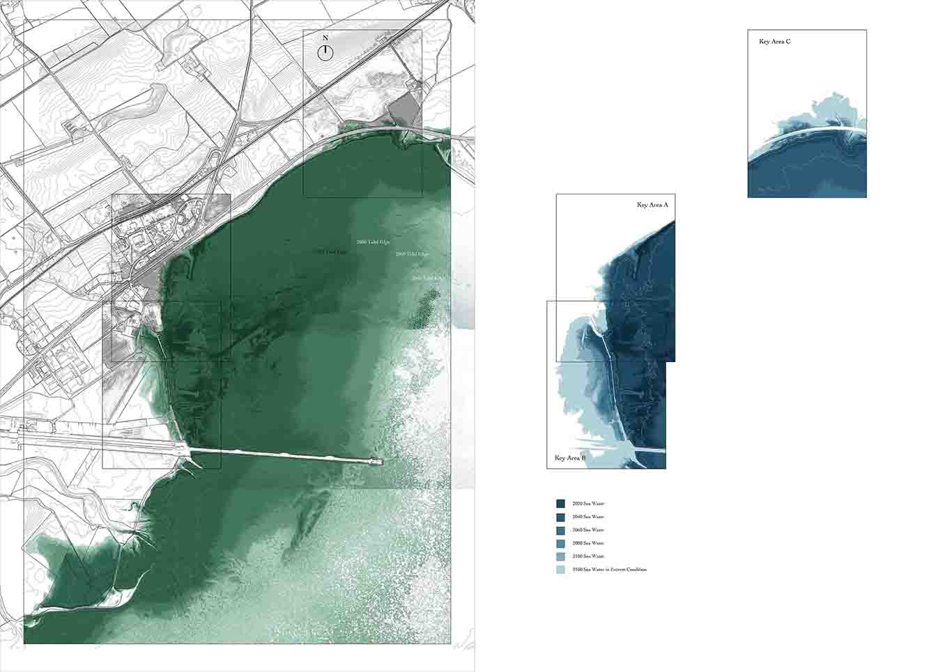
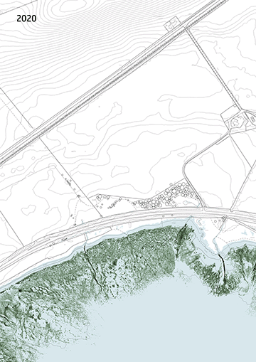
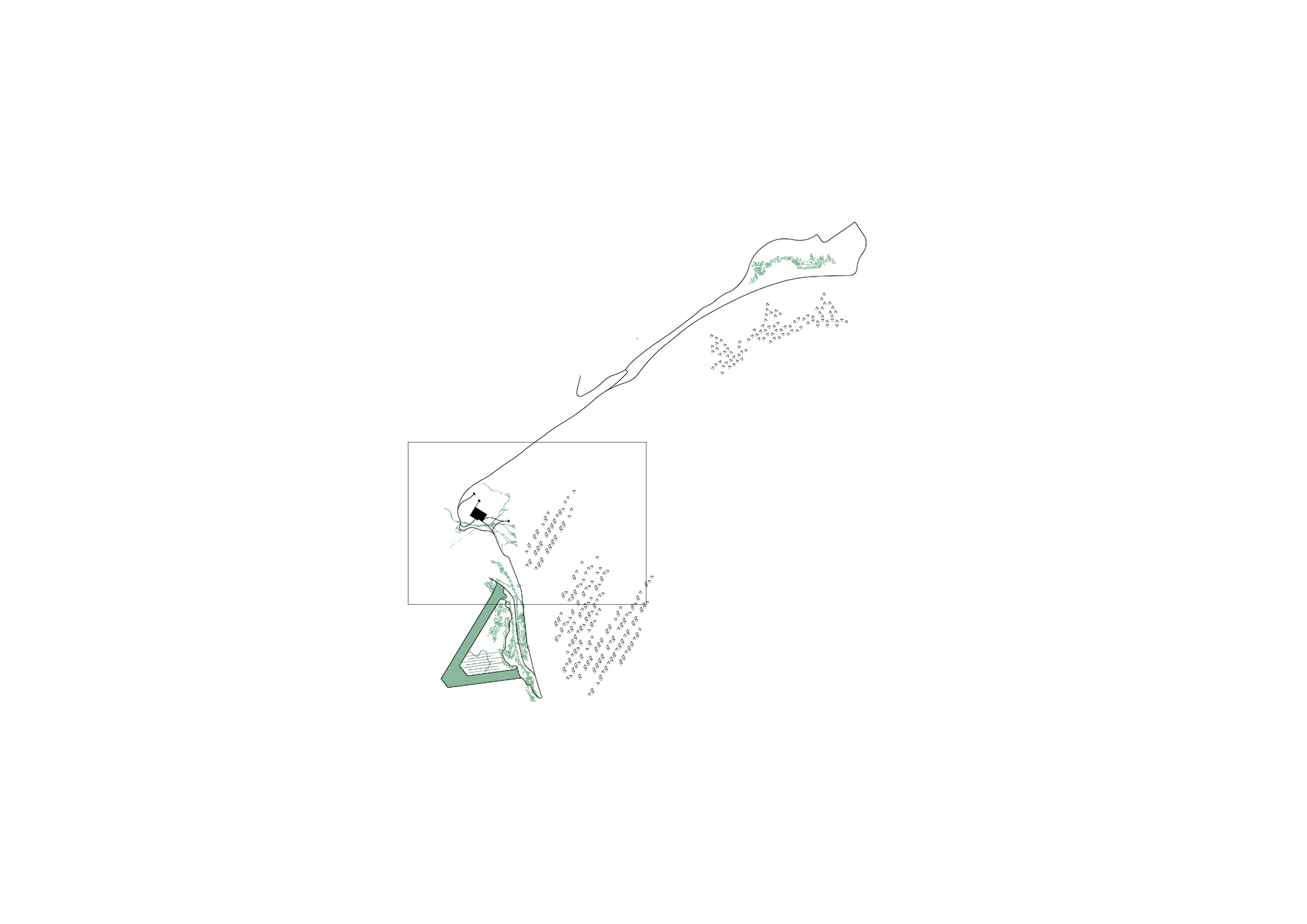
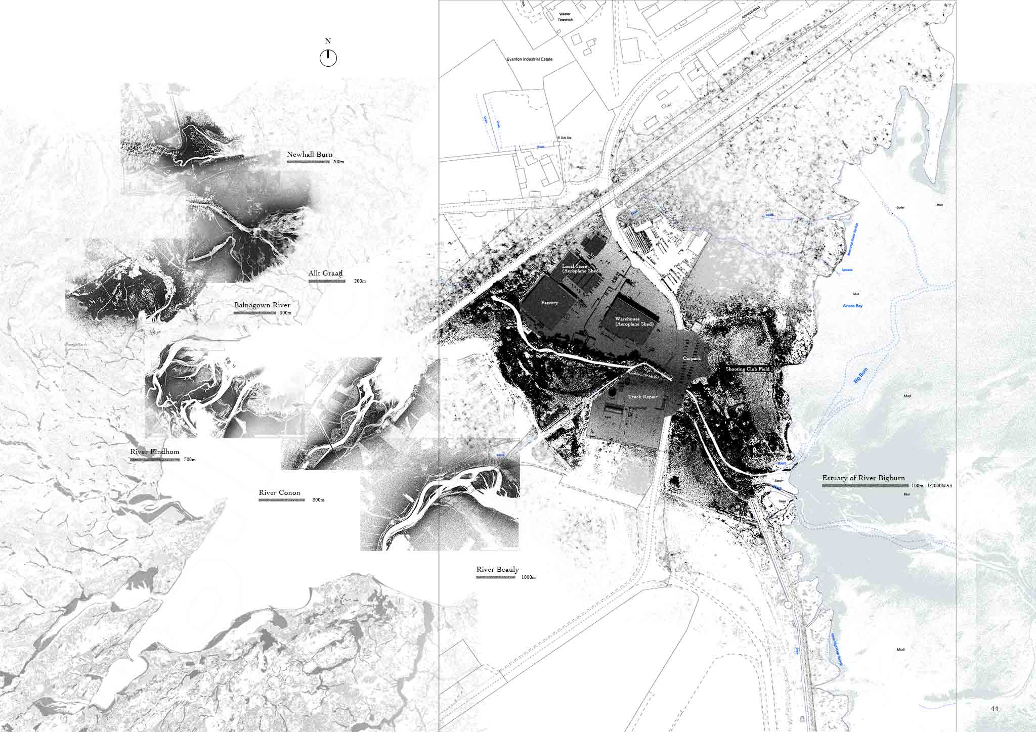
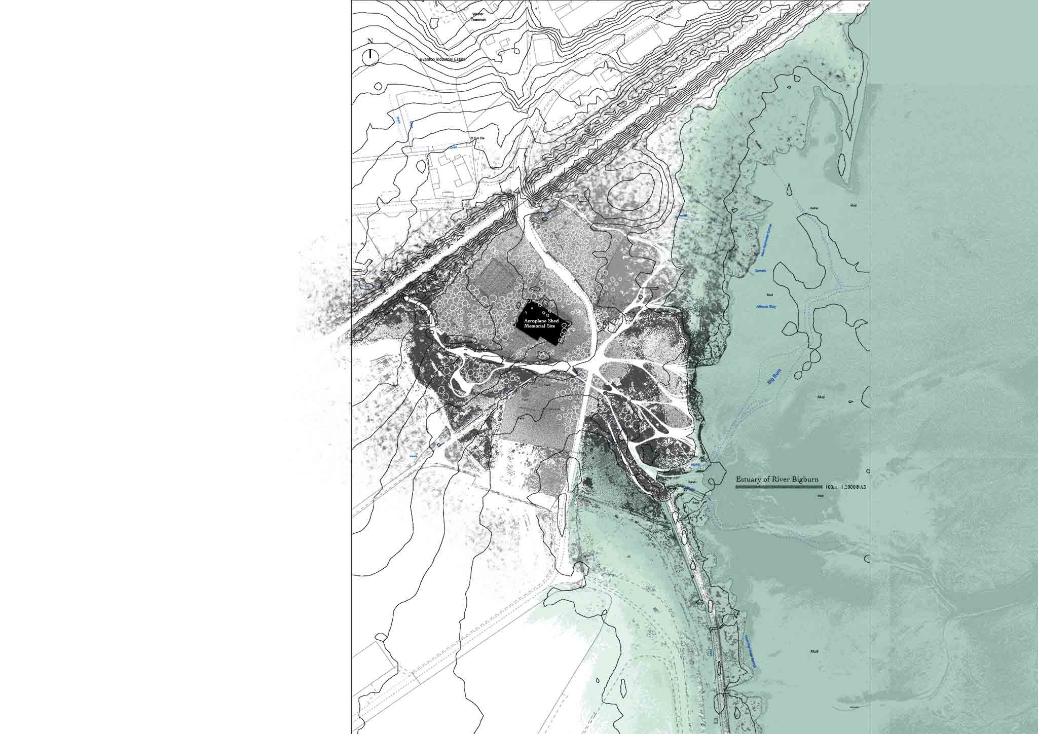
Alness Bay is chosen as the detailed design site because of its special geological and historical status. Because it has the largest saltmarsh and intertidal habitat with very rich sediment sources. And also, the different kinds of world war II historical sites around the Alness Bay coastline are waiting to be conserved. So, it is a potential place to test the strategy of this project. The landscape designed for responding to sea-level rise should find a resilient way to have eternal life.

Chapter I: Recalibrating the Critical Zone

The critical zone is defined as the most dynamic area with multiple relationships with human and non-human elements. In Cromarty Firth, the critical zone is the four large intertidal areas with eelgrass meadows habitat and saltmarsh habitat. Because maintaining the continued existence of these areas requires a delicate dynamic balance, appropriate tidal time, range, water level, sunlight, and air. However, rising sea levels will easily break this balance and make them no longer exist.  

Intertidal zone: the critical zone

The severe contraction of the intertidal zone is an important manifestation of the ecological vulnerability of coastal areas. Due to topographical reasons, the rapid sea-level rise caused the original intertidal zone to be submerged in deep water, while the new intertidal zone was difficult to establish spontaneously. The intertidal zone is defined as a critical zone not only because of its dynamics and fragility, but also because it provides the basis for a variety of ecological environments, habitats, and biological chains, and many wild animals depend on it. Once the intertidal zone disappears, the ecosystem in the area will be severely damaged. This conclusion can be confirmed by overlaying the habitats of various wild animals on the map. In Cromarty Firth, such critical areas are concentrated in four bays or estuaries with large intertidal zones

cromarty firth intertidal ecosystem analysis
Chapter II The Sediment and Beyond the Sediment

Sediment is one of the key factors driving coastal ecosystems. It flattens the coastal terrain and delivers sufficient nutrients to the intertidal habitats. More importantly, the accumulation of sediment on the coast has also created part of the historical sites in the area. The flat terrain and bay of Alness Bay have created good conditions for the British Royal Air Force to build a coastal airport. Sediment is not only sediment, it also has a subtle relationship with ecology and history.

a typical model of sediment flow in intertidal zone and saltmarsh.
History, as Fragile as Ecology

Like the ecological environment, many local historical sites are also at risk of being submerged by the sea and disappearing. During the Second World War, Cromarty Firth was used as an important airport and naval port due to the unique geographical conditions created by sediments. At the end of this century, these World War II relics may no longer exist, and the glorious historical years will gradually be forgotten.

Map of Cromarty Firth
Chapter III Focus on Alness Bay, a Site Where History and Ecological Potential Coexist

Alness Bay was chosen as a detailed design site because it also has a rich and diverse coastal ecological environment, historical sites and sufficient sediment sources. The Allt River Basin has the closest relationship with it.

map of sediment flow in Alness Bay
Zoom in to Alness Bay coastline

The land use form of the coastline of Alness Bay is relatively simple, mainly farmland, part of the land is an abandoned airport, and there is no clear use. The western coastline has linear saltmarsh and coastal woodlands. These habitats have high ecological value. However, in recent years, the development and construction of coastal areas are gradually shrinking these habitats.

current condition map of Alness Bay.
Evanton Airfield, a disappearing place

With the arrival of World War II, the Evanton airfield became HMS Fieldfare between 1937 and 1947. The airfield initially expanded to become a repair base, and a school for flight, bombing and armament training by September 1939, with bomb storage being added by 1940, together with additional buildings for accommodation, transport, servicing, repair and storage. The east-west runway is 1,248 yards long and the northeast-southwest is 1,002 yards long. The airfield was placed on care and maintenance on August 26, 1944, and later saw some civil use after December 1947.

World war two historical heritage map in Alness Bay.
Chapter IV Precisely Predict the Dynamic Systems, Intertidal, Eelgrass Meadows, Saltmarsh and Estuary...

In the context of rising sea levels, landscape design needs to take the time dimension as an important element. In Alness Bay, accurate terrain models and hydrological analysis models are produced to accurately predict the dynamic changes of the intertidal zone, eelgrass meadows, coastal woodland and salt marshes, to discover the key risk areas that need to be designed.

The Shrinking Intertidal Zone

Through the analysis of changes in coastlines and intertidal zones in the next 100 years, it is easy to find some high-risk key areas. Some of these areas may be severely flooded, and some are severely contracted in intertidal habitats.

high coastal risk areas in Alness Bay.
Key Area A

This is an area where coastal flooding occurs, and the expansion of seawater is not serious due to the topography. But the steep terrain makes it difficult to generate new salt marshes.

dynamic coast animation of Alness Bay key area A
Key Area B

This is the flattest area in the coastal area, and a small increase in sea level will bring widespread flooding. Many historical sites during World War II will be flooded as a result, including part of the runway.

the dynamic coastal risks in Alness Bay key area b.
Key Area C

In this area, seawater invades farmland through culverts under the highway, causing soil salinization. Humans need to evacuate farmland and return it to nature to rebuild salt marshes. In addition, the intertidal zone in this area has a large contraction range, which will affect the habitat of eelgrass.

the dynamic coastal risks in Alness Bay key area c.
Chapter V: The Strategy, Generate New Sediment, Manage the Sediment

Some historical scenic spots on the coast have undergone a natural transformation while retaining the original historical features, they have a rich and diverse vegetation community and water bodies for the generation and transportation of sediments. In the intertidal zone, sediment barrier matrixes will be deployed to intercept and drain sediment.

Reclaiming the legacy of the Anthropoce

The material of the Sediment barrier comes from the steel support structure of the abandoned oil rig. His interior is filled with gravel and sand so that eelgrass can grow on it. His side skin is filled with concrete slabs, these concrete slabs have a very unique profile so that marine life can grow on them.

the design of sediment barrier
the design of sediment barrier matrix
The transformed historical landscape

The runway can form water bodies and wetlands by adjusting the terrain. The source of these water bodies can be connected to the Big Burn River and the Allt Graad River by pipelines. Plants, fish and wading birds thrive here, and new sediments are constantly being generated and eventually flow into the sea.

animation of imagenation in coastal disued airfield runway
The transformed historical landscape

The original seawall and pillbox will be submerged after the sea level rises, and new landscapes can be built based on these facilities, such as boardwalk and bird watching platform. In this way, the traces of these facilities have been preserved and human participation has been enhanced.

the animation of landscape imagenation at disusee seadike.
Chapter VI: The Design of Coastal Memorial Geopark Sequence

The adaptive coastal landscape in the context of rising sea levels is a combination of multiple design elements, and no single measure can achieve the functions of sediment management and historical heritage protection.

master plan of this project
master plan navigation page 1
runway wetland park master plan.
The Transation Bubble System

The transition bubble system is used between the saltwater habitat and freshwater habitat. It consists of a lot of seasonal ponds that allow salt water and fresh water in due to high tide event of rain flooding. It can help plants establish their community in the transition zone, especially for saltmarsh grass. Also, this bubble system can help to generate sediment. 

planting plan of bubble system
Generating Sediment From Memorial Site

Section of runway wetland park and bubble system, from macro scale to micro-scale.

runway wetland park sections.
master plan navigation page 2
master plan of hidden aeroplane shed memorial park
Estuary Occupied by Human

The surrounding area of the River Big Burn estuary is highly occupied by human facilities. When the sea level rise, it will not have much space to expand. But for many other healthy estuaries, all have many branches to cover a huge area to deposit sediment and cerate habitat. So it is very necessary to reclaim the estuary land for the river.

collection of estuary landform pattern
Return the Natural Form to the Estuary

The new river branches are designed according to the topography, forming a natural estuary landform. Land for factories, parking lots and shooting ranges was recovered and returned to coastal woodland. A larger hangar was retained and transformed into a greenhouse.

estuary design
master plan navigation page 3
master plan of eelgrass meadows reserve
Student list
open list
close list