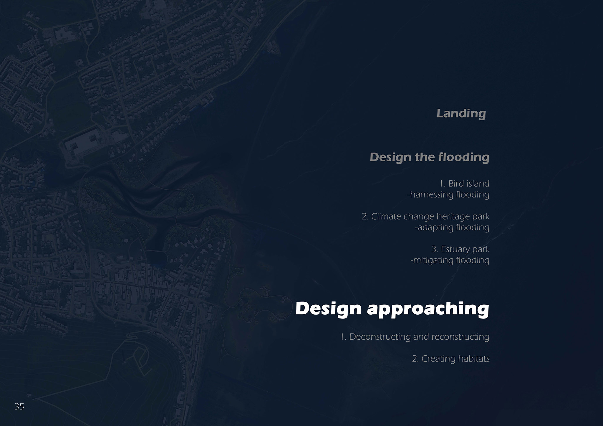
This project is about how the Cromarty Firth region responds to the sea level rise risks in the future. The project consists of three parts, the bird island, the climate change heritage park, and the estuary park. These three parks reflect three kinds of degree dealing with coastal flooding risks. The first degree is harnessing the positive aspects of the flooding area. The second one is adapting to the flood. The third one being mitigating the flood. From a landscape architect’s point of view, only fighting against coastal flooding is not a sustainable method to respond to climate change, an adaptive landscape design with more resilience is needed in the Anthropocene.
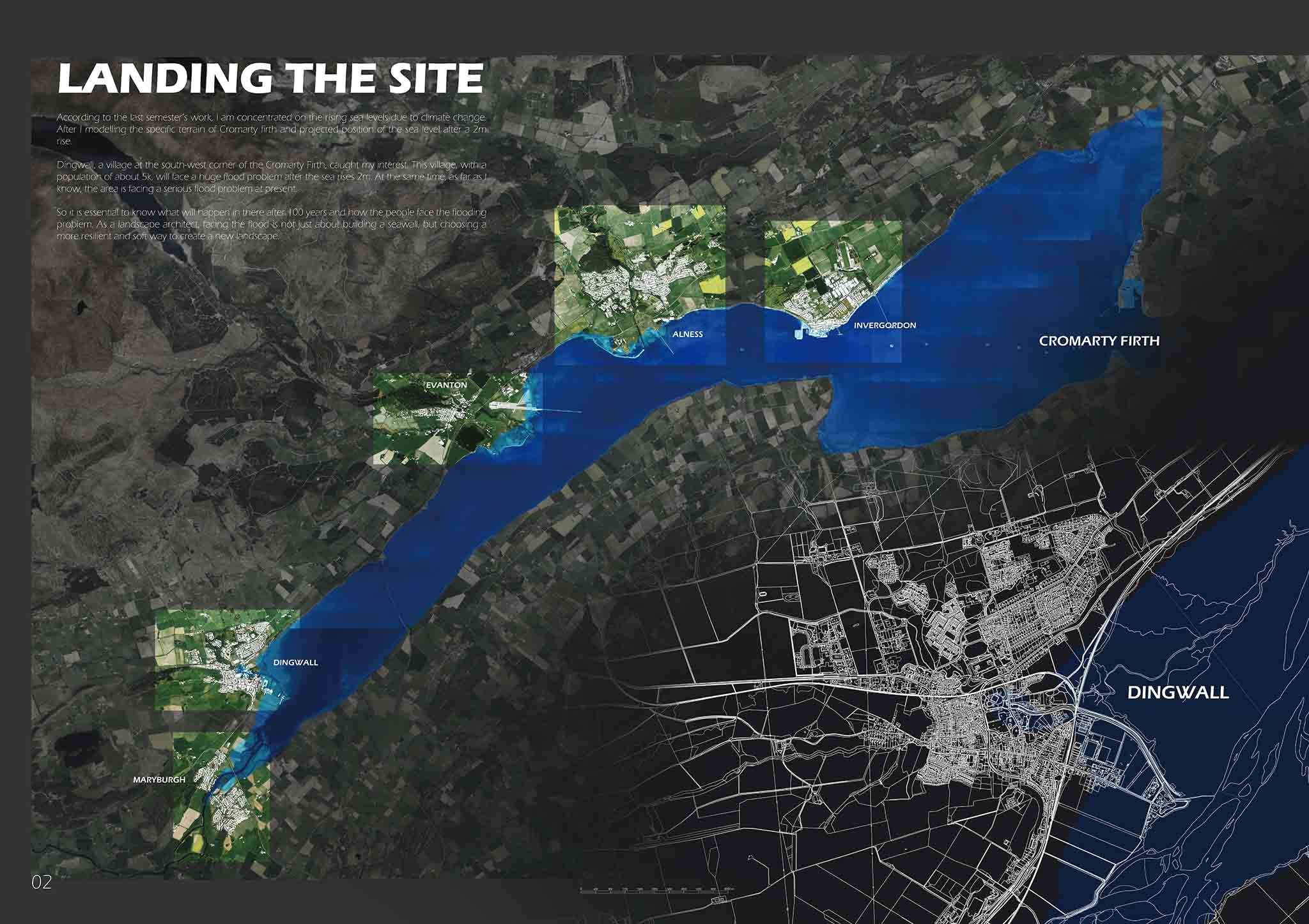
According to the IPCC (2019) document, the sea level will rise 2 meters in the extreme condition in the next 100 years. This dramatic change will cause most coastal areas of the world to suffer coastal risks, such as flooding, coastal erosion, more intense storms, etc. As a typical coastal low-lying area in Scotland, Cromarty Firth’s coast is having these risks in a specific way. The settlement, humanity, history, ecology and wildlife all inhabit the coast. So, the design of this project will take Dingwall, one of the largest settlements in Cromarty Firth with a 5 thousand population, as a test field to implement adaptive landscape design.
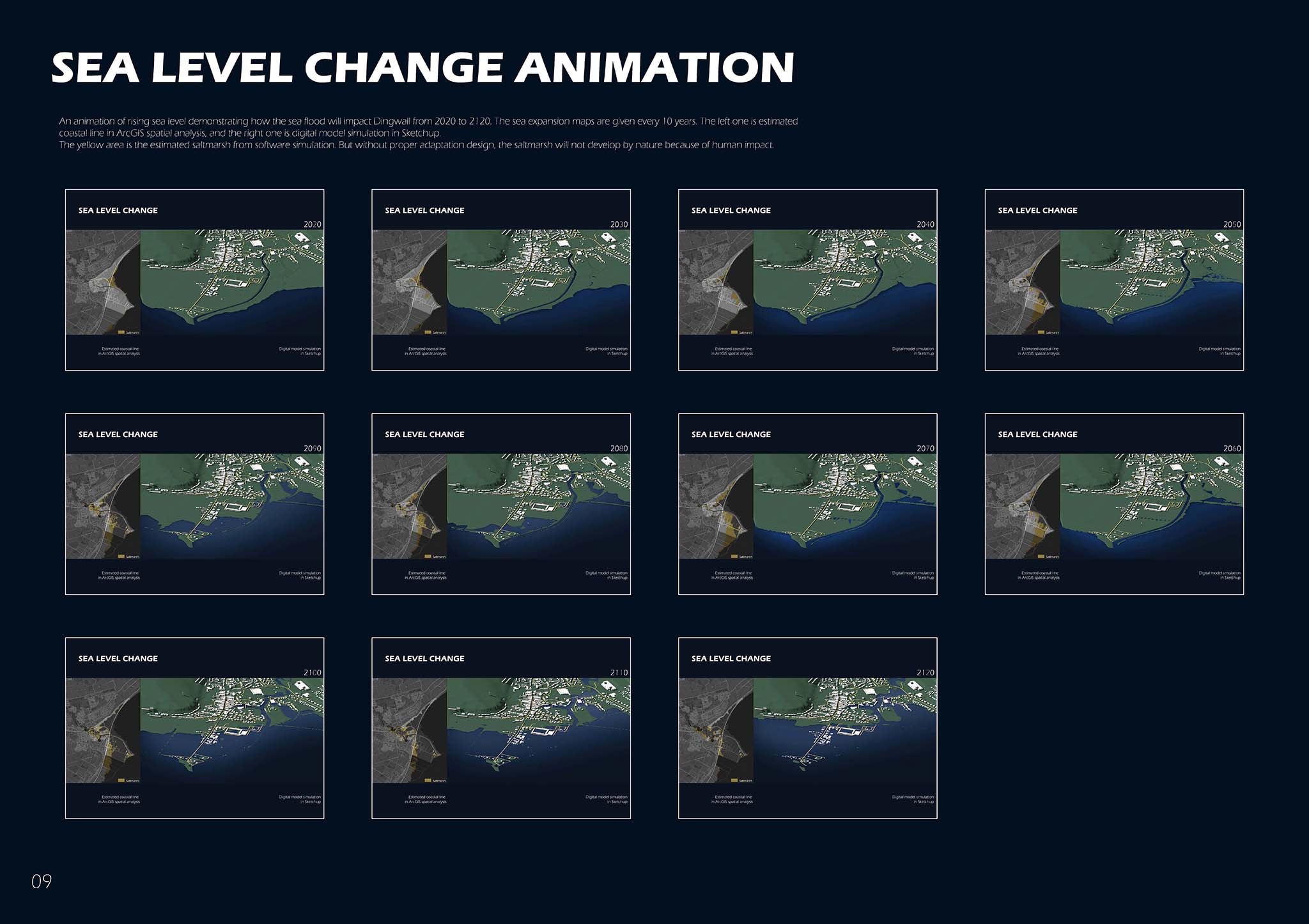
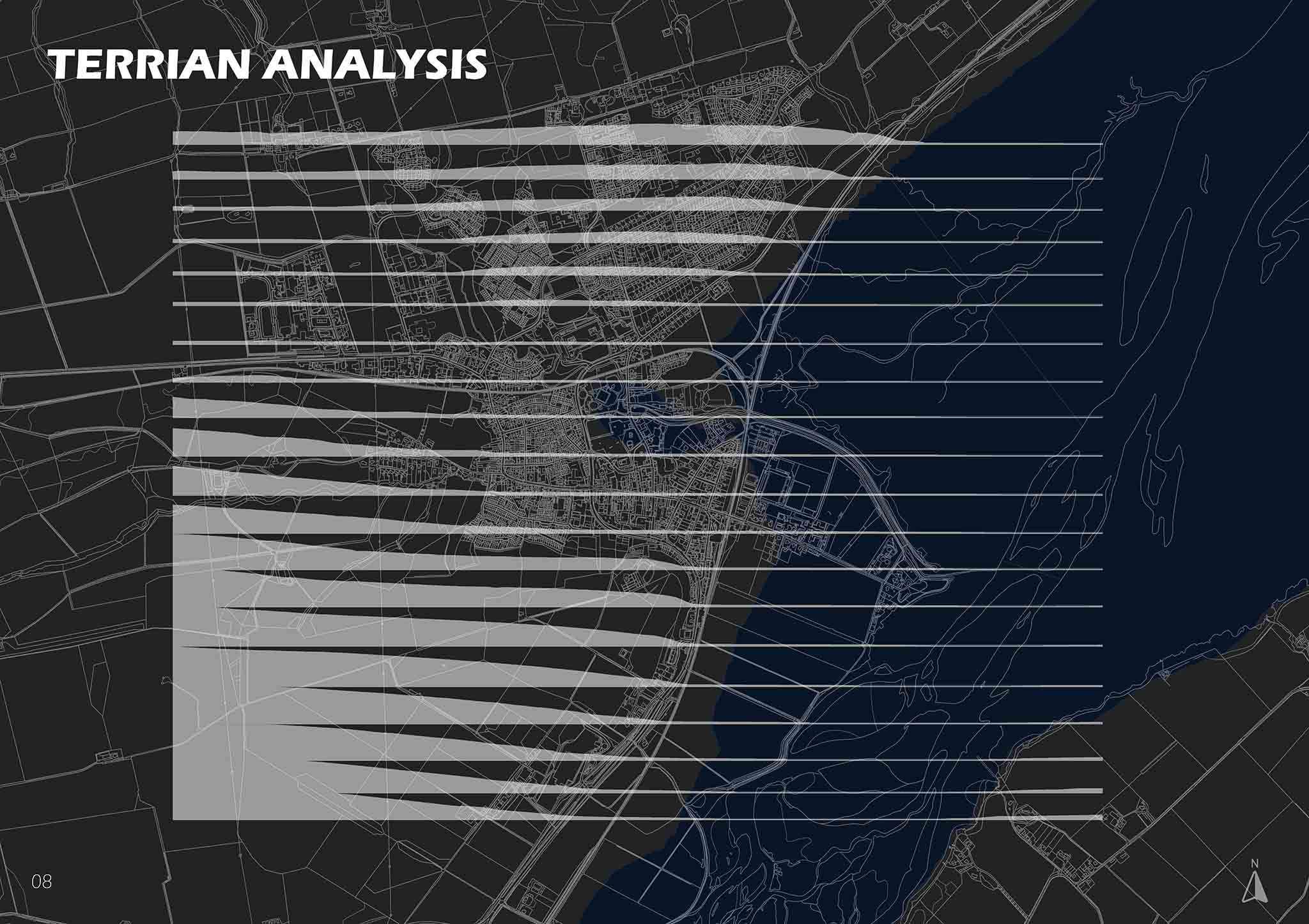
The principle of this design is retreating from high-risk areas, recycling materials from the communities that will be submerged in the future, releasing the flooded coast for wildlife habitat, and finally, use the recycled material to reconstruct new coastal landscape for human and non-human. It is different from building a huge concrete sea dike directly for the next 100 years, all this design process is phased, based on the prediction timeline of sea expansion in Dingwall coast. To make sure the sea level rise prediction is reasonable, ArcGIS analyzing tool is used.
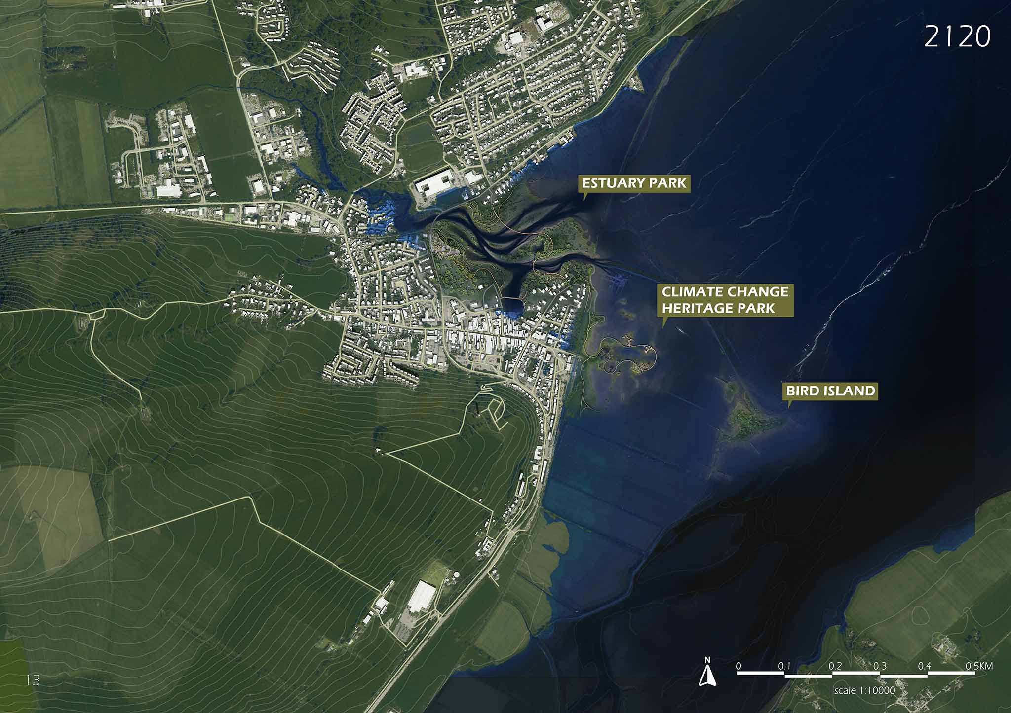
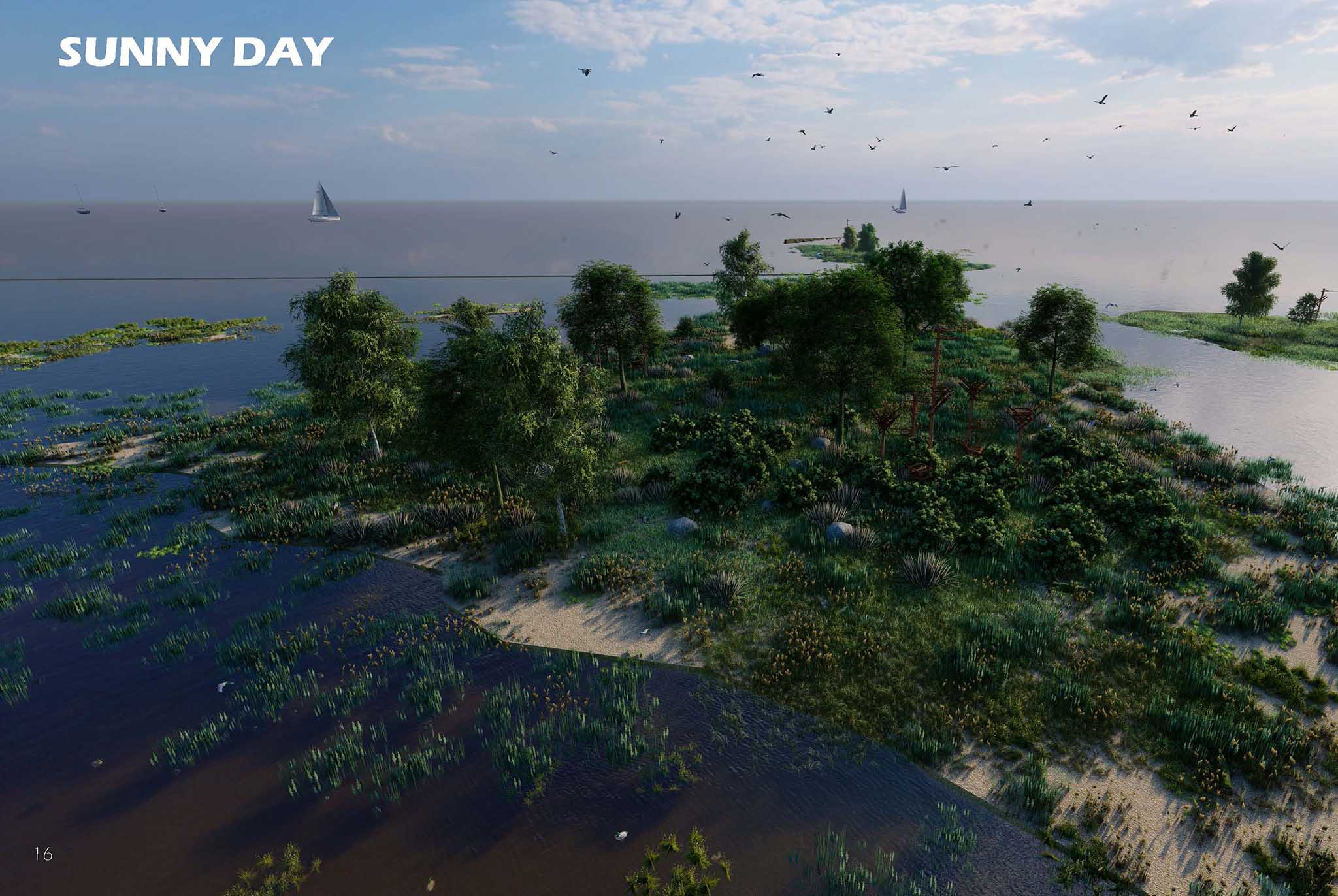
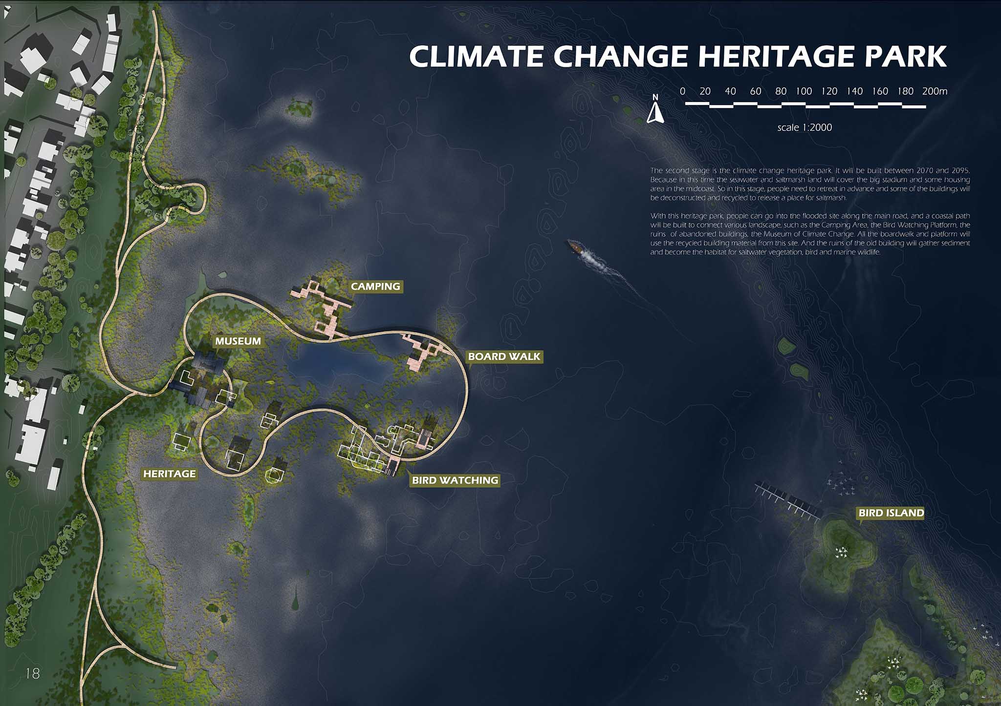
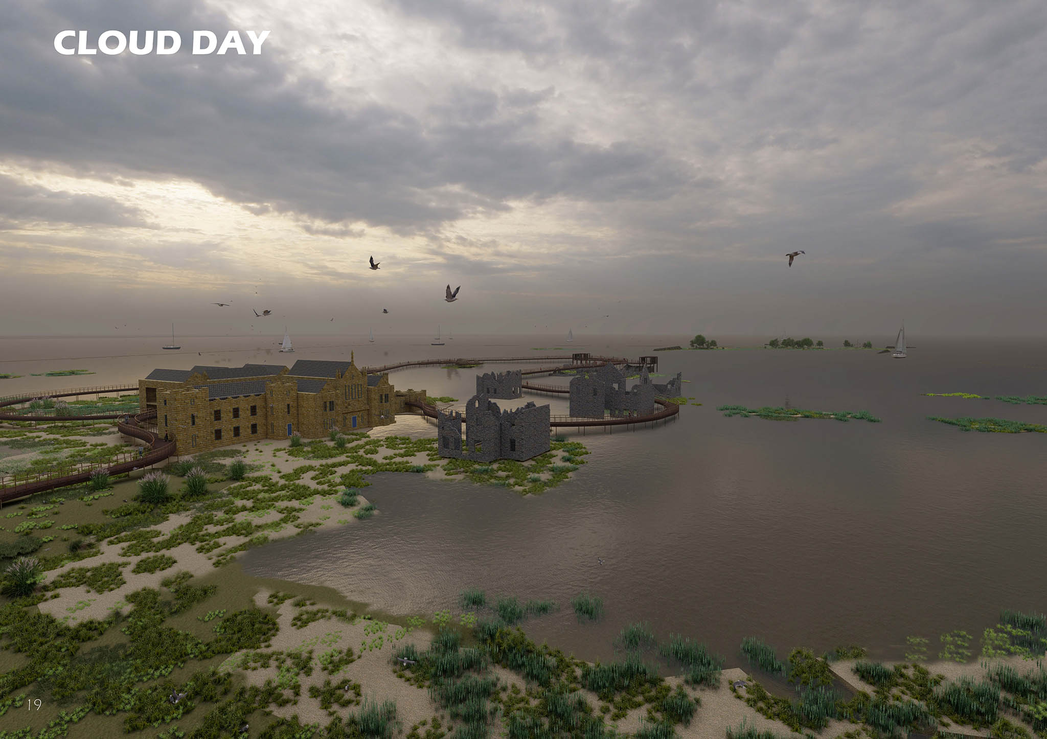
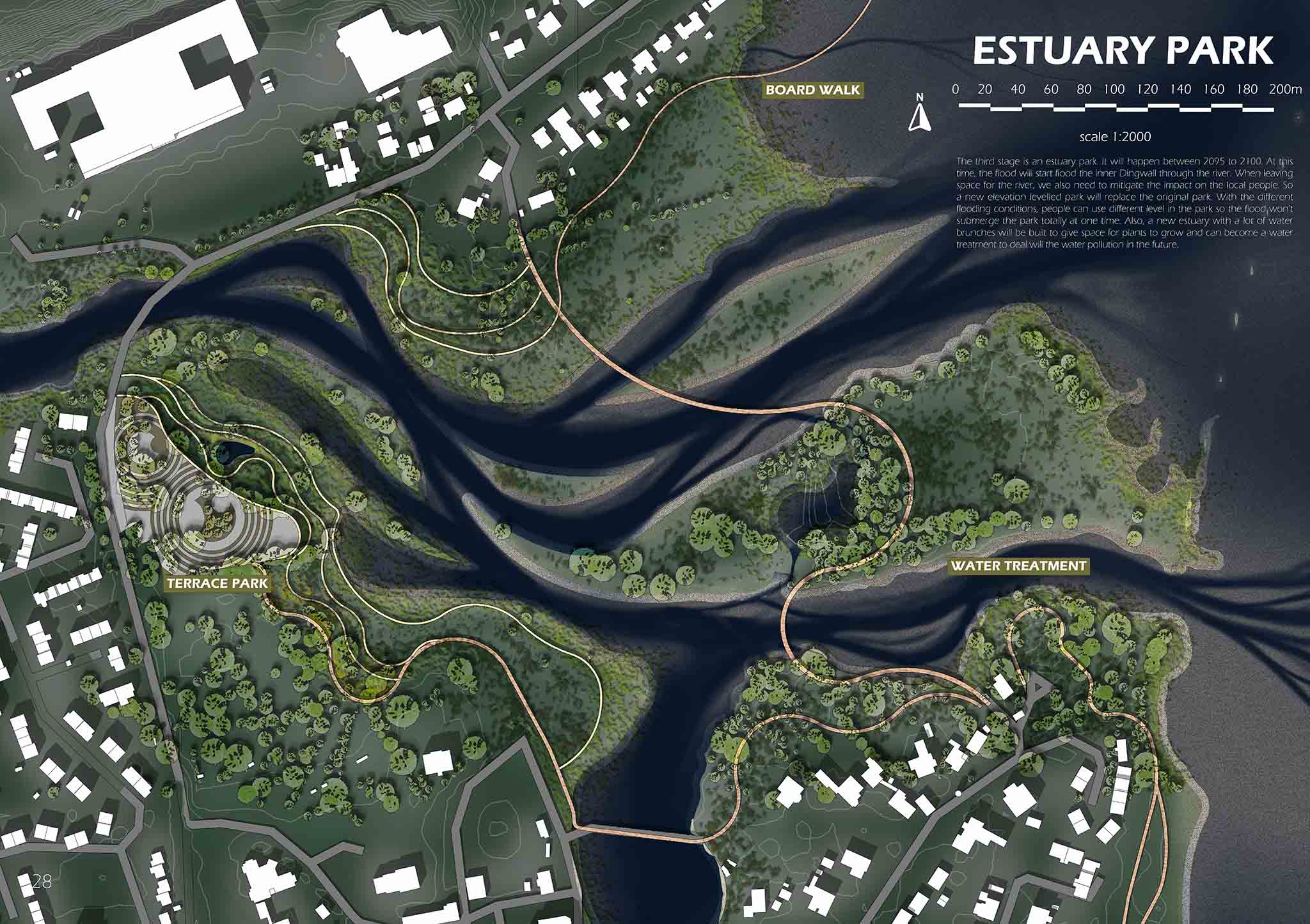
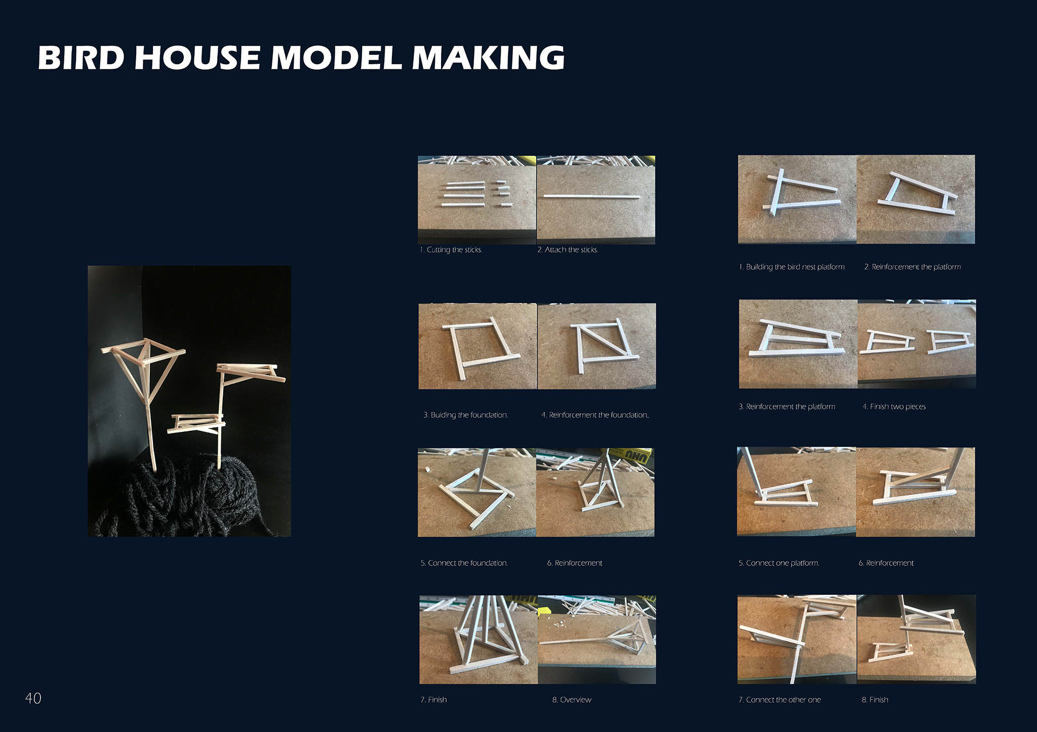
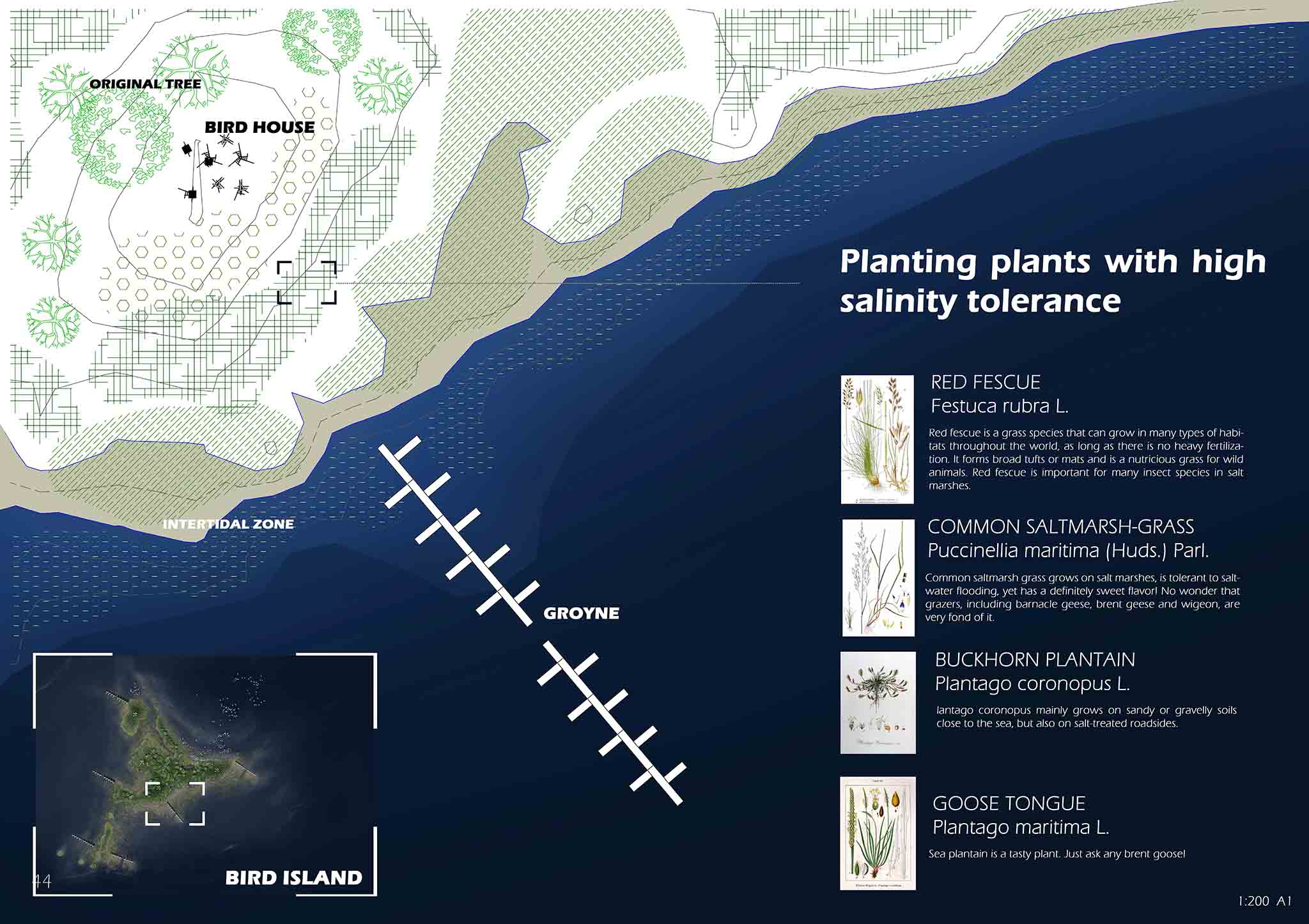
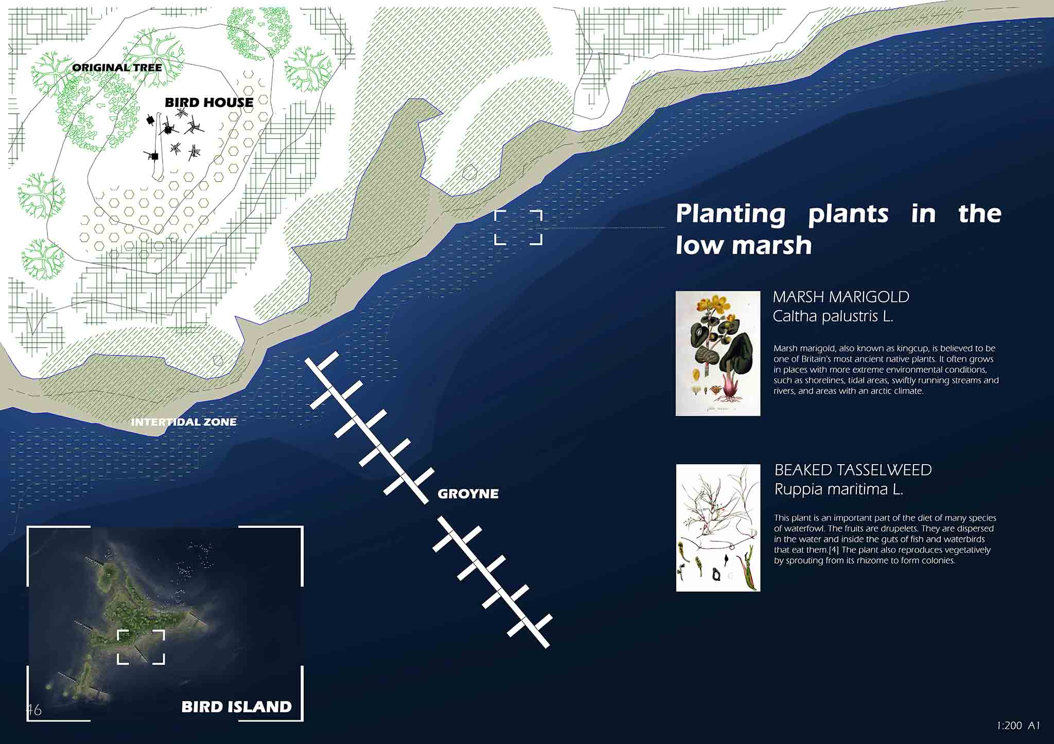
The first key time is 2045, it is the time when the sea expansion starts influencing the south part of Dingwall. It will be separated from the mainland by the sea expansion process in the next few years and become an island. So, before this happens, a retreat plan is made to protect local people but also ensure the coastal habitat expansion can keep pace with the sea-level rise. This island reflects the first degree of dealing with sea flooding. So, it is named bird island, a site designed totally for the wildlife with some specific landscape facilities. The second key time is 2070, it is the time when the sea flooding covering the middle Dingwall coastal community. After people retreat from this area, many buildings will gradually stand in the shallow tidal zone, be occupied by nature gradually, and gradually become ruins. A climate change heritage wetland park will be designed based on the heritage of the disappearing ruins. It reflects the second degree of facing sea-level rise. And give people the opportunity to think about the impact of the Anthropocene and the relationship between human and nature while allowing them to reuse submerged areas. The third key time is 2095, at this time the sea will flood the inner Dingwall through the canal estuary. A new estuary park with a terrace park and water treatment will be designed to mitigate the negative impact of flooding and make the estuary area a new space for humans and non-human. The resilience design is used here to balance the dynamic space between human and flooding. It represents the third degree of dealing with sea-level rise in this project.
In conclusion, this project attempts to respond to rising sea levels with an adaptive landscape design. While the Anthropocene has allowed humans to dramatically reshape nature, fighting irreversible climate change will lead to unsustainable development. Avoiding conflict, living with the sea may be away.